Posts

Showing posts from May, 2020

Hazachhara Waterfall/Jharna- The Beauty of Nature.
Image
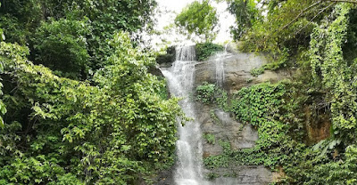
Hazachhara Waterfall/Jharna- The Beauty of Nature. The Nature of Hazachora Waterfall/Hazachora Jharna: At present, there is a thirst for travel among almost all people. These people who love to travel are a little lovers of the sea, mountains, nature and springs. Whenever he has time, he goes out to see these places at home. But mountain-springs; If you want to get the embrace of the two together, you can come back from Khagrachori hill district. Here you will see several fountains together. Hazara fountain is one of them. It is located in Baghaihat area of ​​ Baghaichori upazila of the district. After a 15-minute walk along the main road, you will reach the foot of the Hazachora waterfall. The Waterfall has now become very attractive to tourists visiting Sajek Valley . Hazachora Waterfall/Hazachora Jharna Despite being close to the Hazachora locality, the environment of the Waterfall is still very wild. The icy water of the Hazachora Waterfall and the lush green wat
Shuvolong waterfall -One of nature's unique creations

Image
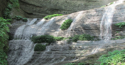
Shuvolong waterfall - One of nature's unique creations Introduction: Bangladesh, one of the world's natural beauty destinations, has several tourist spots, including the Rangamati district in the Chittagong division. One of the most interesting places in Rangamati is the Shuvolong Waterfall . This waterfall can only be reached by water, so tourists use boats to get here. You can reach this fountain in just 5 minutes from Shuvolong Bazaar. The combination of surrounding hills and waterfalls makes this place one of the most beautiful green lands for tourists. Shovolong Waterfall Nature: Shuvolong Waterfall/Jharna  is located next to Shuvolong Bazar, just 25 km from Rangamati Sadar. Like all other waterfall in Bangladesh, Shuvolong waterfall have very little water. During the monsoon season, a huge stream flows from a hill about 140 feet high into Kaptai Lake . The beauty of the way to see the Shuvolong Waterfall can make you emotional. Seeing the lake fl

Kaptai Lake -The combination of mountains, waterfalls, water and greenery.

Image
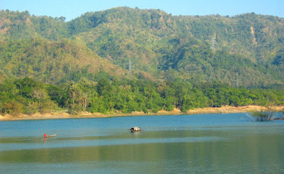
Kaptai Lake -The combination of mountains, waterfalls, water, and greenery Introduction:         Kaptai Upazila of Rangamati district has been standing in the center of Chittagong Hill Tracts for many years with its unique beauty of nature. Kaptai Upazila is unique for its hills, clear waters of Kaptai Lake, and eye-catching greenery. Kaptai Lake covers an area of ​​11,000 sq. km. Kaptai Lake is the largest lake in South Asia. Here you can see small and big hills, winding mountain roads, waterfalls and the combination of water with green. On the one hand, just as there are various plants and animals in the mountains, there are many species of fish and endless biodiversity in the deep waters of the lake. The environment around the lake, the small islands , the variety of birds, and the life of the water-centered people will fascinate you. Although artificial, nature has embellished Kaptai Lake in all its forms. Kaptai Lake can be visited all year round. However, in the ra

Sajek Vally- Life in the Valley of the Clouds

Image
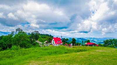
Sajek Vally- Life in the Valley of the Clouds Introduction: Bangladesh is a riverine country. To the south of which is the hilly Rangamati . Sajek Valley is one of the most attractive places in Bangladesh for those who are thirsty for travel. Sajek Valley  is a paradise for those who love mountains and fountains. Sajek Valley for those who love to play with clouds. Sajek Valley Location: Sajek Valley is located at Kachalong Hill Range in Baghaichhari upazila of Rangamati district. The valley is 2000 feet above ocean level. Sajek is an association situated in north of Chittagong Hill Tracts. It is arranged 67 km north-east from Khagrachhari town and 95 km North-West from Rangamati city. Sajek River that begins from Karnafuli waterway and this stream fills in as a fringe among Bangladesh and India. Sajek valley is well known for its normal magnificence. Sajek valley is the Queen of Hills and Roof of Rangamati. Sajek Valley Cause of Names: The name of S

St. Martin's Island of Bangladesh

Image
St. Martin's Island, Bangladesh           St. Martin's Island is not a big island (the area not more than 36 km 2 ) in the northeastern part of the Bay of Bengal, there is a small adjacent island this is separated at the excessive tide, referred to as Chera Dwip . It is set eight kilometers (five miles) west of the northwest coast of Myanmar, on the mouth of the Naf River . St. Martin's Island Map in Google          Millenia in the past, the island was an extension of the Teknaf peninsula, but at a later time some portion of this peninsula got submerged and for this reason, the southernmost part of the aforementioned peninsula became an island and turned into disconnected from the Bangladesh mainland. The first settlement began 250 years in the past by way of Arabian sailors who named the island 'Jazeera'. The island was named after the then Deputy Commissioner of Chittagong, Mr. Martin, during the British occupation of St. Martin . The neighborhood